Chile
San Pedro de Atacama & The Atacama Desert Itinerary: How Many Days + Sample Plans
Hyper-arid salt flats, high-altitude geysers, and the world’s clearest night skies.
Traveler rating
Loved by landscape and night-sky photographers.
Plan & book
Sort your San Pedro de Atacama & The Atacama Desert trip in one place.
We point you to the booking tools we'd actually use — live prices, no markup. Or let us build the day-by-day plan around you first, then book.
Pick your trip length
How many days do you need in San Pedro de Atacama & The Atacama Desert?
Each of these opens a full day-by-day plan you can make your own.
- 2 days — Two days — the essentials, no rushing.
- 3 days — Three days — the icons plus one neighborhood.
- 4 days — Four days — a full city without sprinting.
- 5 days — Five days — room for a day trip.
- 7 days — A week — the city at a human pace.
- With Kids trip — Shorter days, earlier dinners, what to skip.
- For Couples trip — Two-person pacing with evenings built in.
- Solo trip — A plan that works well on your own.
- Food trip — Meals and markets as the anchors.
- Outdoors trip — Nature, walks and open air.
- Culture trip — History, museums and the streets around them.
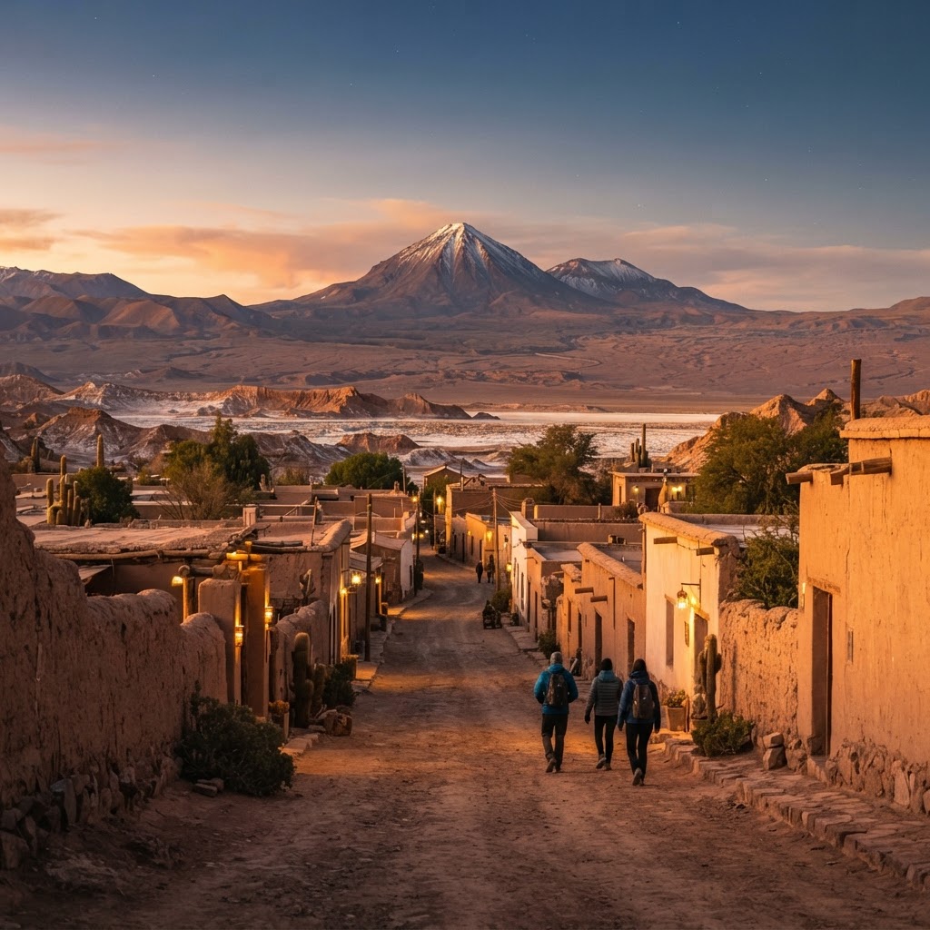
San Pedro de Atacama sits at 2,400 meters elevation in the driest non-polar desert on Earth. A compact, unpaved oasis town of adobe facades and dusty alleyways, it serves as the operational staging ground for dramatic high-altitude exploration: surreal salt basins, jagged wind-carved canyons, geothermal fumaroles at dawn, and celestial stargazing shielded from light pollution.
4 to 5 days
Best time
March to May and September to November for clear skies, mild midday temperatures, and manageable crowds.
Build your own trip with these prebuilt itineraries
Each one is a tested, day-by-day plan for San Pedro de Atacama & The Atacama Desert — start here, then make it yours.
4 Days in Atacama: Classic Landscapes & Acclimatization in Atacama Desert/San Pedro
Essential highlights paced carefully for elevation, from low-altitude salt flats and moonscapes to dawn at El Tatio
6 Days in Atacama: Self-Drive High-Altitude Adventure in Atacama Desert/San Pedro
An active off-the-beaten-track 4x4 road trip exploring remote altiplanic lagoons, thermal canyons, and high-altitude volcano treks
5 Days in Atacama: Astronomy & Celestial Wonders in Atacama Desert/San Pedro
Night-sky photography, professional observatory tours, and dark-sky reserves scheduled around the new moon
Go for raw geological scale and astronomical clarity that exists almost nowhere else on the planet. From floating weightlessly in hyper-saline lagoons to standing beside roaring steam vents at 4,320 meters while the sun breaks over the Andes, Atacama delivers dramatic physical shifts across short driving distances.
Where to stay
Getting there
Getting around
Food & drink
What it costs
Skip it if
Skip this destination if you have severe cardiopulmonary conditions aggravated by high altitude (sights climb from 2,400 to over 4,300 meters), if you rely on smooth paved accessibility for mobility devices, or if you expect vibrant nightlife and beach relaxation.
When to go
Summer brings warmth but risks sudden 'Altiplanic winter' rains that wash out high-altitude roads, while winter plunges morning excursions well below freezing. The shoulder months deliver transparent night skies and stable 20°C to 25°C daytime weather without peak holiday crowds.
Peak (December–February)
Warmest weather and lively town energy, but high summer crowds drive up lodging rates and Bolivian winter storms can abruptly close El Tatio or Baltinache.
Shoulder (March–May & September–November)
The ideal window for hiking and astronomy with stable weather, 20°C to 25°C days, crisp nights, and lower excursion rates.
Low (June–August)
Unrivaled celestial clarity for astrophotography, but pre-dawn departures to El Tatio routinely face temperatures below -10°C.
Neighborhoods
Where you stay shapes the trip. Here's how to think about it.
Casco Histórico (Town Center & Calle Caracoles)
Dusty adobe streets, tour outfitters, packed artisanal craft stalls, and lively patio restaurants.
Best for:First-timers, solo travelers, and anyone prioritizing walkable access to tour departures and dining
Don't miss:Browsing the local gear shops along pedestrianized Calle Caracoles before grabbing a craft beer at Adobe.
Ayllo de Larache & Solcor
Tranquil agricultural ayllus dotted with ancient chañar trees, irrigation canals, and secluded luxury eco-lodges.
Best for:Couples, luxury travelers, and those wanting profound desert quiet within a 15-minute walk to town
Don't miss:Walking the shaded dirt lanes bordered by mud walls toward Explora Atacama at twilight.
Ayllo de Quitor
Dramatic red sandstone canyon country 3 kilometers north of the town plaza, framed by pre-Inca defensive ruins.
Best for:Active adventurers, cyclists, and landscape photographers wanting direct trail access into the desert rim
Don't miss:The steep foot path climbing up the Pucará de Quitor fortress for sunset panoramas over the San Pedro River basin.
Ayllo de Coyo & Tulor
Sprawling, windswept rural oasis south of town with expansive views of the Licancabur volcano silhouette.
Best for:Stargazers, high-end resort travelers, and return visitors seeking zero light pollution
Don't miss:An open-sky nocturnal walk beneath the southern constellations well away from village streetlamps.
Destination intelligence
Updated 10/6/2026The structured record we plan every San Pedro de Atacama & The Atacama Desert itinerary from.
Walkability
High within the compact village core; zero beyond town borders.
Transit quality
Low (no municipal public transit; relies on shared shuttles and tour operators).
Car needed
Optional but advantageous; a rental car unlocks quiet hours at key reserves, though tour operators cover every route.
Ideal duration
4 to 5 days
Minimum useful
3 days
Peak season
December through February (Chilean summer holidays, warmest days, busier trails, but risks occasional 'Altiplanic winter' cloudbursts).
Shoulder season
March to May and September to November (crisp, transparent skies, moderate temperatures, and manageable crowds).
Low season
June through August (Southern Hemisphere winter brings freezing sub-zero nights and bitter high-altitude winds, but crystal-clear skies).
Best for
Common mistakes
- Rushing to El Tatio Geysers on morning one and succumbing to severe acute mountain sickness (soroche).
- Failing to drink double your usual water intake; the desert air is so dry your sweat evaporates instantaneously.
- Booking evening stargazing tours during the full moon when celestial wash obscures the Milky Way.
- Packing only hot-weather clothes; desert nights and early morning geyser departures routinely drop below freezing.
Best nearby
How to plan it
- Stay within four blocks of Calle Caracoles if you want walkable access to restaurants and early morning tour pickups.
- Schedule El Tatio Geysers (4,320m) for day four or five at the earliest to prevent altitude headaches and nausea.
- Align your trip dates with the new moon if celestial photography or stargazing is your trip's primary objective.
- Never drive from Calama to San Pedro after dark if you are unfamiliar with unlit desert highways and sudden livestock crossings.
- Book national reserve entry tickets online in advance through community portals, as remote ranger stations rarely accept on-site cash.
Questions
More in Chile
Readymade itineraries
Start from a tested template — then make it yours.
Ready to book
Lock in your San Pedro de Atacama & The Atacama Desert trip
Everything in one place. We may earn a small commission — it never costs you more.
Plan a trip to San Pedro de Atacama & The Atacama Desert
Pick a length and we'll build a day-by-day plan around how you travel — neighborhoods clustered, budget-aware, and editable.
Get better at planning trips like this
Occasional notes on planning smarter — no spam, unsubscribe anytime.
Plan a trip to San Pedro de Atacama & The Atacama Desert
Turn this guide into a day-by-day plan built around your pace, your group, and your budget.
Build my San Pedro de Atacama & The Atacama Desert trip